Storm Josephine Unleashes Coastal Flooding and Strong Winds Along the Eastern Seaboard
- Nishadil
- October 23, 2026
- 0 Comments
- 2 minutes read
- 3 Views
- Save
- Follow Topic
Subtropical Storm Josephine brings high tides, gale‑force gusts and dangerous surf to the Atlantic coast
Josephine, a 65‑mph subtropical storm, hovers off New England, prompting flood warnings from the Mid‑Atlantic up to Atlantic Canada while packing a punch of powerful winds.
On Thursday, October 22, the National Hurricane Center kept a close eye on Subtropical Storm Josephine as it lingered offshore, yet its influence was anything but distant. The system, with sustained winds touching 65 mph (100 kph), sat roughly 200 miles southeast of Nantucket and about 420 miles south‑southwest of Halifax, drifting northeast at a steady 12 mph.
Even from that distance, Josephine was sending waves crashing onto beaches from the U.S. Mid‑Atlantic all the way up to Atlantic Canada. The National Weather Service slapped a gale warning on parts of the Northeast and Mid‑Atlantic, meaning gusts above 39 mph (63 kph) were likely through mid‑morning Friday. Small craft were warned to stay clear of the surf, especially around North Carolina’s Outer Banks, where rip currents could turn deadly.
Coastal flooding, while not catastrophic, was expected to be “minor to moderate” along the Mid‑Atlantic shoreline. Residents in places like New York, New Jersey and Maryland were advised to monitor tide levels and keep sandbags handy, just in case the high tide combined with the storm‑driven surge pushed water onto low‑lying streets.
Looking ahead, forecasters say Josephine will keep moving away from the United States, staying south of Nova Scotia and Newfoundland. Yet paradoxically, the storm is forecast to strengthen as it transitions into an extratropical cyclone, potentially rattling the region with hurricane‑strength winds by Friday night.
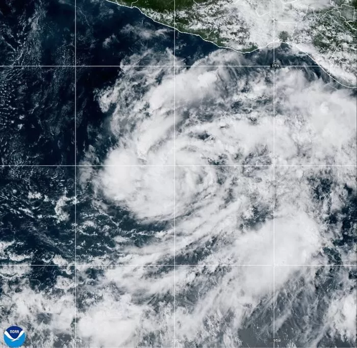
Meanwhile, on the opposite side of the continent, Tropical Storm Vance was chugging along far off Mexico’s southwestern coast. Early Thursday, Vance clocked 60 mph (97 kph) winds and was slated to become a hurricane before the day’s end, sitting roughly 505 miles south of Acapulco.
Both systems underscore how quickly the Atlantic and Pacific can produce weather that feels extreme, even when the storms themselves are still miles away. Authorities are urging people to stay informed, keep an eye on local advisories, and avoid unnecessary travel on the water until conditions improve.
In short, while Josephine isn’t set to make landfall, its peripheral impacts—strong gusts, coastal flooding, and dangerous surf—are real enough to merit attention. And for those watching the Pacific, Vance’s rapid intensification is a reminder that another storm could be brewing just down the line.
Editorial note: Nishadil may use AI assistance for news drafting and formatting. Readers can report issues from this page, and material corrections are reviewed under our editorial standards.