Odisha Braces for Intense Rainfall and Thunderstorms as Depression Looms
- Nishadil
- August 19, 2026
- 0 Comments
- 3 minutes read
- 10 Views
- Save
- Follow Topic

IMD Issues Orange Warning for Four Odisha Districts, Heavy Rains Expected Tomorrow
Odisha is gearing up for a significant spell of wet weather, with the India Meteorological Department issuing 'Orange' and 'Yellow' warnings for various districts. Tomorrow, August 19th, is expected to see heavy to very heavy rainfall, accompanied by thunderstorms and gusty winds, all driven by an active depression.
Well, it looks like Odisha is in for a rather wet and wild ride over the next few days, particularly tomorrow, August 19th. The India Meteorological Department (IMD) has issued some pretty serious warnings, with four districts placed under an 'Orange Warning' – meaning folks there should brace for heavy to very heavy rainfall. It’s certainly a situation worth keeping a close eye on.
So, which districts are facing the brunt of it tomorrow? According to the latest update from August 18th, Sundargada, Jharsuguda, Bargada, and Sambalpur are the ones under that 'Orange Alert'. We're talking about rainfall that could really be quite significant. Along with the downpour, these areas, and indeed several others, can expect thunderstorms, complete with lightning and gusty surface winds that could reach speeds of 30-40 kmph. Imagine that — not just rain, but a proper stormy feel!
But it's not just those four; a 'Yellow Warning' for heavy rainfall has also been issued for a good number of other districts. This includes Debagada, Anugola, Kendujhar, Mayurbhanj, Subarnapur, Boudh, and Balangir. Essentially, a wide swathe of Odisha needs to be prepared for some significant wet weather. And on top of that, thunderstorms, lightning, and those gusty winds (30-40 kmph) are forecast to sweep across many northern and coastal parts of the state for the next five days, touching places like Ganjam, Gajapati, Nayagarh, Khordha, Puri, and Cuttack. So, a good umbrella (and maybe even a raincoat!) is definitely in order.
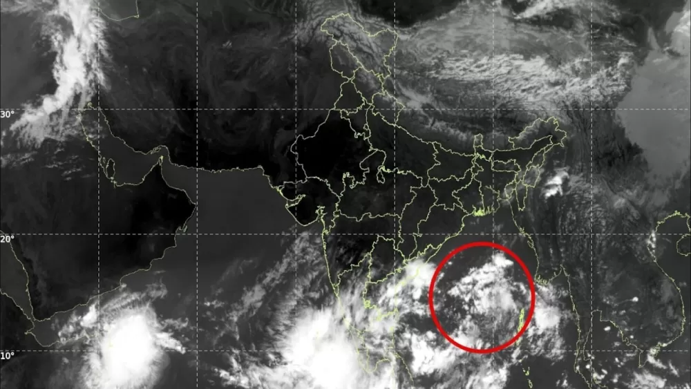
You might be wondering, what's causing all this dramatic weather? Well, weather watchers are pointing to a depression. As of yesterday morning, August 18th, this system was hanging out over Jharkhand and parts of Gangetic West Bengal. It's been slowly chugging west-northwestwards, and while it's expected to weaken into a well-marked low-pressure area within the next 24 hours as it moves across Jharkhand and Bihar, its influence on Odisha's weather is clearly going to be felt.
Now, let's look a bit further out. While tomorrow seems to be the peak for some areas, the wet weather isn't just going to vanish. For August 21st and 22nd, isolated heavy rainfall is still quite likely over Odisha, with specific yellow warnings for Mayurbhanj, Keonjhar, and Sundargarh districts on the 21st. Then, as we move into August 23rd, Mayurbhanj might once again see heavy downpours, with widespread thunderstorms, lightning, and those pesky gusty winds affecting coastal and nearby districts like Baleshwar, Bhadrak, Jajpur, Kendrapada, and many more. Even into August 24th and 25th, parts of Kendujhar and Mayurbhanj could still be experiencing heavy rainfall.
Overall, the broader outlook for East and Northeast India, stretching into early September, suggests fairly widespread to widespread rainfall. Odisha, along with states like Arunachal Pradesh, Assam, Meghalaya, West Bengal, and Sikkim, can expect isolated heavy to very heavy falls on many days. This persistent rainfall, of course, brings with it a low to moderate flash flood risk in certain watersheds over the next 24 hours. So, really, the message is clear: stay informed, heed the warnings from the IMD, and take all necessary precautions to ensure safety during this extended period of unsettled weather. Nature's definitely putting on a show, and it’s always best to be prepared.
Editorial note: Nishadil may use AI assistance for news drafting and formatting. Readers can report issues from this page, and material corrections are reviewed under our editorial standards.